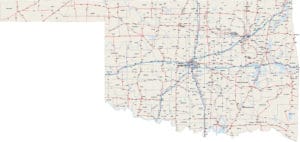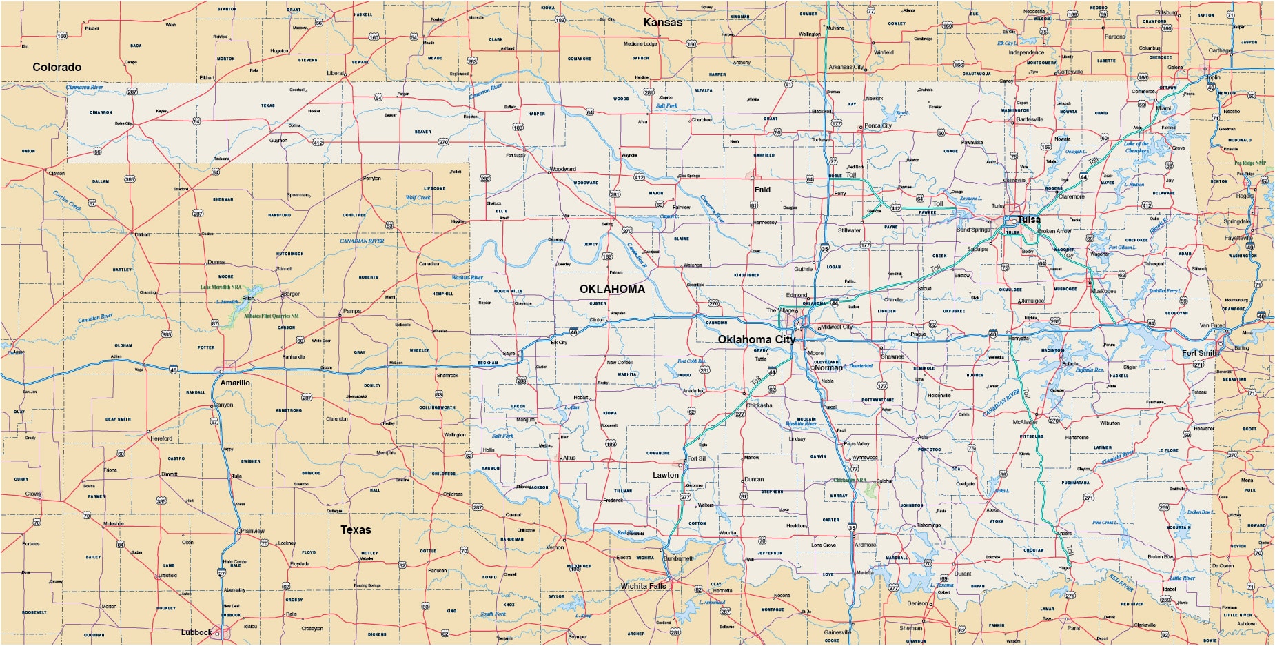
Oklahoma Map
Price: $85.00
Item # 3073
Oklahoma map contains portions of surrounding states to fill the page.
Oklahoma digital map is currently 19″ by 9.6″, but is completely scalable to wall map size. All 77 counties are fillable polygons.
Creative Force Maps:
- You receive both the Adobe Illustrator and PDF files immediately.
- Fully-Editable.
- Royalty-Free (and they really are—no licenses to autosign).
- High-Resolution, so go ahead and blow it up.
Layer Directory
- State Polygons
- State Boundaries
- State Names
- Metro Areas
- County Polygons
- County Boundaries
- County Names
- Capitals
- US Major Cities
- Large Cities
- Medium Cities
- Small Cities
- Interstate Highways
- Interstate Centerline
- Interstate Highway Numbers
- Interstate Highway Symbols
- US Roads
- US Road Numbers
- US Road Symbols
- State Roads
- Coastline
- Bay/Sea Names
- Major Lakes
- Major Lake Names
- Major Rivers
- Major River Names
- Intermediate Rivers
- Intermediate River Names
- National Parks
- National Park Names