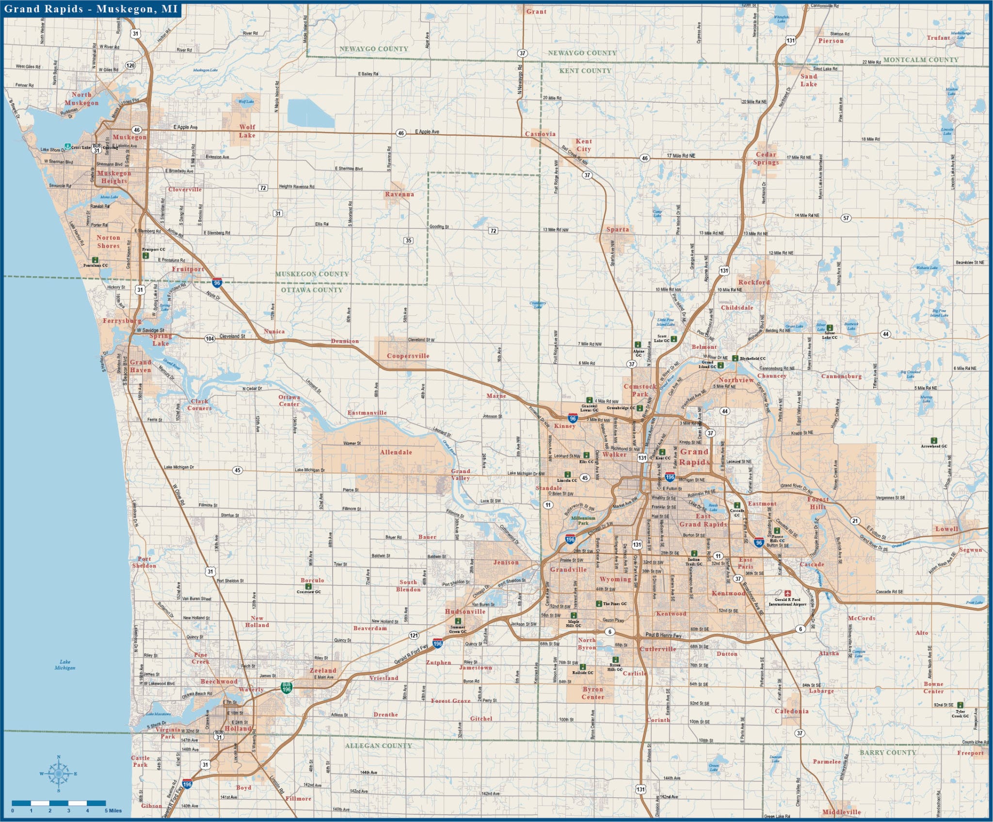
Grand Rapids to Muskegon Metro Overview with Local Roads Map
Price: $195.00
Item # 4055
Grand Rapids to Muskegon Metro area map contains arterial, major and local roads.
Our Grand Rapids to Muskegon Metro Overview with Local Roads Digital Map is currently 18.8″ by 15.5″, but is completely scalable. We can extend the map, in any direction, at a minimal cost. We can also print, laminate or mount any of our vector maps. Contact us for options and pricing.
Creative Force Maps:
- You receive both the Adobe Illustrator and PDF files immediately.
- High-Resolution, so you can blow it up to wall map size.
- Fully-Editable and logically layered.
- We can extend the map at a minimal cost.
- Royalty-Free.
Layer Directory
- Map Boundary
- Legend
- Highway Symbol
- County Text
- City Text
- Landmark Text
- Freeway Text
- Primary Road Text
- Secondary Road Text
- Water Text
- Landmark Symbol
- Freeway Center
- Freeway
- Primary Road
- Secondary Road
- Local Road
- County Boundary
- Water Line
- Water Area
- Landmark Area
- City Area
- Background